Looking at the map of the Indian subcontinent, it is not geographically obvious how the borders of India and what was then Pakistan (East and West) were decided. On first inspection, it looks similar to the division of Northern Africa after WWII and to what is irrevently referred to as Churchill’s Sneeze: a nonsensical zigzag in the boundary between Jordan and Saudi Arabia. Examining the map, you have to wonder why on earth they would create a country separated by an enemy country in between? What were they thinking?
A little history helps. During the Partition—as the dissolution of the British Indian Empire is still referred to within Bangladesh and is akin to how the American Civil War is still referred to as the War of Northern Aggression by some in the South—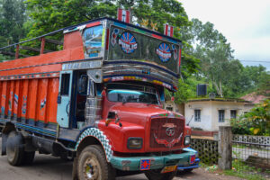 borders were decided based on religion. Hindu West Bengal went to India, and Muslim East Bengal (now Bangladesh) became a province of Pakistan. Only later did it become clear that religion alone did not make for strong country building. In 1971, the two Muslims sections of Pakistan separated into Pakistan and Bangladesh along ethnic lines.
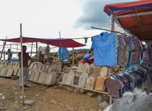 Monuments to the slain Bengali students who protested the outlawing of their language, Bengali, and the institution of Urdu as the national language, stand in many of the public places in Bangladesh.
Driving north of Sylhet toward the Indian border, it certainly appears that someone on the Indian side had a crystal ball and foresaw that the climate would change. Rising ocean levels and exploding population all combine to make life on the delta tenuous. There is no mistaking where Bangladesh ends, and India begins. You simply look across the plain, and where the mountains begin, so does India. We drove to this border region to see the Hanging Bridge and watch stone harvesting.
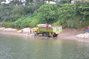
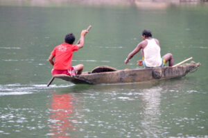 Stone harvesting is a remarkable activity that has been practiced for as long as people have needed stones. Men and boys paddle long wooden canoes to the middle of the river and then dive to the bottom with jute baskets that they fill with stones. These get brought up and
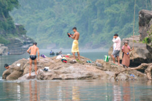 deposited at the bottom of the canoes until the canoes are full. They then paddle to shore and unload the canoes one basketful at a time. Another set of men loads the stones into the back of trucks, again one basketful at a time. The piles of stones are then crushed by manual labor into building materials for roads, buildings, etc., and hauled across the country. This repeats itself hundreds of times a day, every day except Fridays, a Hindu holiday.
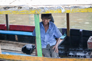
Along the riverbank, people were buying and selling goods—including tombstones, bathing, collecting stones, fishing, filling jugs of water, and just waiting around. Some were waiting for the colorful buses that would take them across into India or further into Bangladesh.
The backdrop for all of this is the Hanging Bridge: an ethereal suspension bridge that spans the river in a gap between two cloud-shrouded mountains. Zia rented us a leaky, flimsy boat and we rode on the roof to the area below the bridge, careful not to cross over onto the Indian side. There is no love lost between India and Bangladesh. A few months before we arrived, an Indian border guard shot and killed farmers who he claimed were 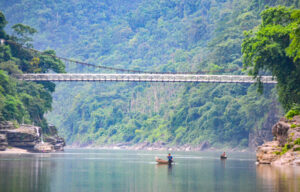 planting on Indian territory. The bamboo border posts sit on hilltops, not more than a football field’s length apart, facing off, guardians of this incredible human rock-gathering effort. It is a joke on the Indians that the Bangladeshi are stealing India one basketful at a time. Given
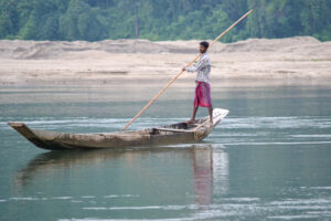 the number of men diving day in and day out to gather stones, they might actually accomplish the task. Someday, there will be no mountains left along the border. They will be the roads and buildings of Bangladesh.